
Explaining the differences between ZCTAs, zip codes, and other interesting bits.
In 1963 the United States Postal Service introduced the “Zone Improvement Plan” - now what everyone everywhere knows as ZIP codes. ZIP codes are ultimately for the express purpose of grouping up the countless addresses found in the United States and its territories to make mail delivery a simpler and expedited process. It’s for that reason that our ZIP code is so vital to every delivery we order online; who knows how much longer it could take without that level of organization.
So then when you look at Censtats, why are you instead seeing ZCTA?
ZCTA stands for “ZIP Code Tabulation Area” and is markedly different from how the standard ZIP operates. For the most part, ZIP codes and ZCTAs actually correspond to one another (the ZIP code 10001 is also the ZCTA 10001). Where any differences come up is what area is being covered per ZCTA and if any ZIP codes are being grouped together for census reasons. One of the key areas where this is found is with P.O. boxes; let’s take this example from the Manhattan borough in Censtats: New York City:
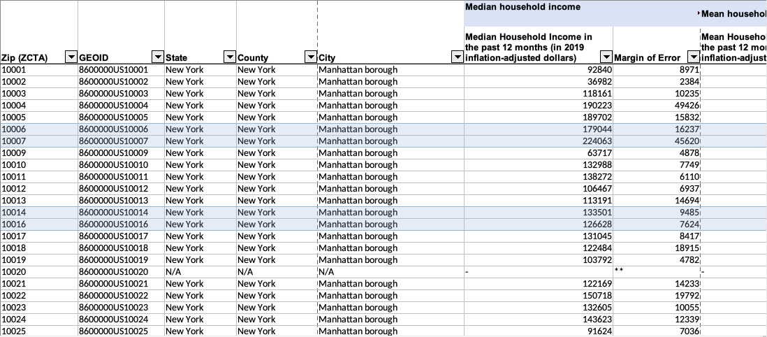
Starting with 10001, it looks like all ZIP codes are accounted for… except 10008 and 10015. This is because, as alluded to previously, these two are rather unique ZIP codes that are tied to P.O. boxes, and therefore fundamentally differ from how traditional mailing addresses are grouped to form ZCTAs (i.e. nobody lives at a P.O. box). So what’s the solution? Simple: add the odd one out to the most sensible adjacent ZCTA.
Now, if you look just below 10008 and 10015, you’ll see something else a bit odd:

It gets worse when you scroll even further down in Censtats: New York:
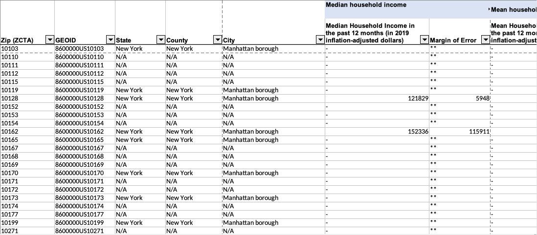
The good news/bad news is that N/A is still the most accurate available information on a ZCTA. You can imagine that with a place like Manhattan that there are a lot of landmarks and federal buildings real close to one another, and that becomes a bit of an issue when sorting through data. P.O. boxes are given special privileges because of their direct relation to mailing addresses; even though they are small locations, they are servicing surrounding ZIP codes on behalf of the Postal Service.
This is opposed to how all those “N/A” ZIPs work. Just look at how they appear on a Census map, once again representing Manhattan:
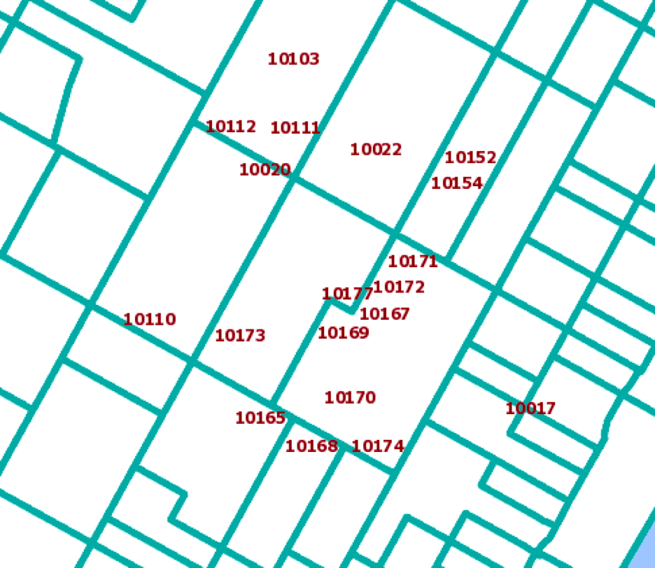
Most, if not all, of these ZIPs are not linked to the Postal Service and are such small locations without residential purposes that they are left on their own and end up with a sweeping row of N/A, -, and ** since there’s no quantifiable information to gather from them.
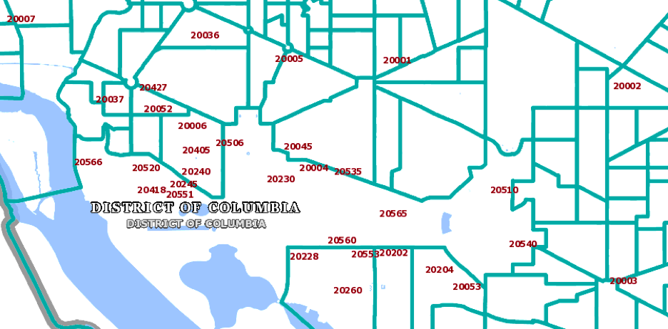
You’ll get the same visual in many other places, like the District of Columbia:
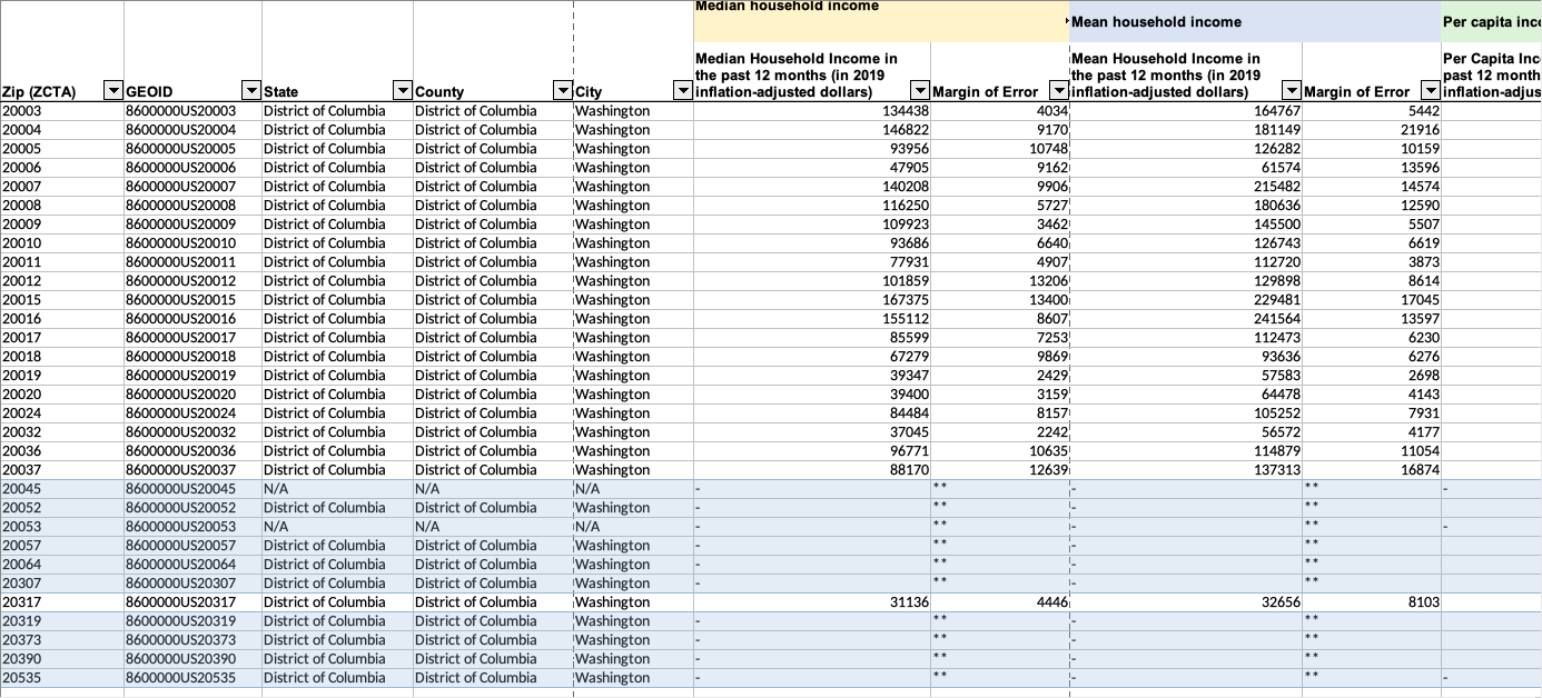
So the basic answer to “Is there a difference?”: yes and no. Yes, there’s a clear fundamental difference, but for the most part ZIP codes and ZCTAs are going to align. Where there are missing ZIPs found in our Censtats bundles usually means that they were absorbed into another ZCTA, and where there are symbols like N/A, -, and ** means that the location doesn’t have quantifiable data due to size.
A great resource that serves as a “crosswalk” between what ZIP code corresponds to what ZCTA was created by UDS Mapper and can be found at: https://udsmapper.org/zip-code-to-zcta-crosswalk/.
For more information on how the Census uses ZCTAs, you can read here: https://www.census.gov/programs-surveys/geography/guidance/geo-areas/zctas.html.
Header image sourced with permission from adidad8.
This September marks the third annual campaign to raise disaster readiness and response education
A look at the Census Bureau's newest developments on the next decennial census